LIZ NUNES 561.351.4529 | CHIP ARMSTRONG 561.371.3787

-
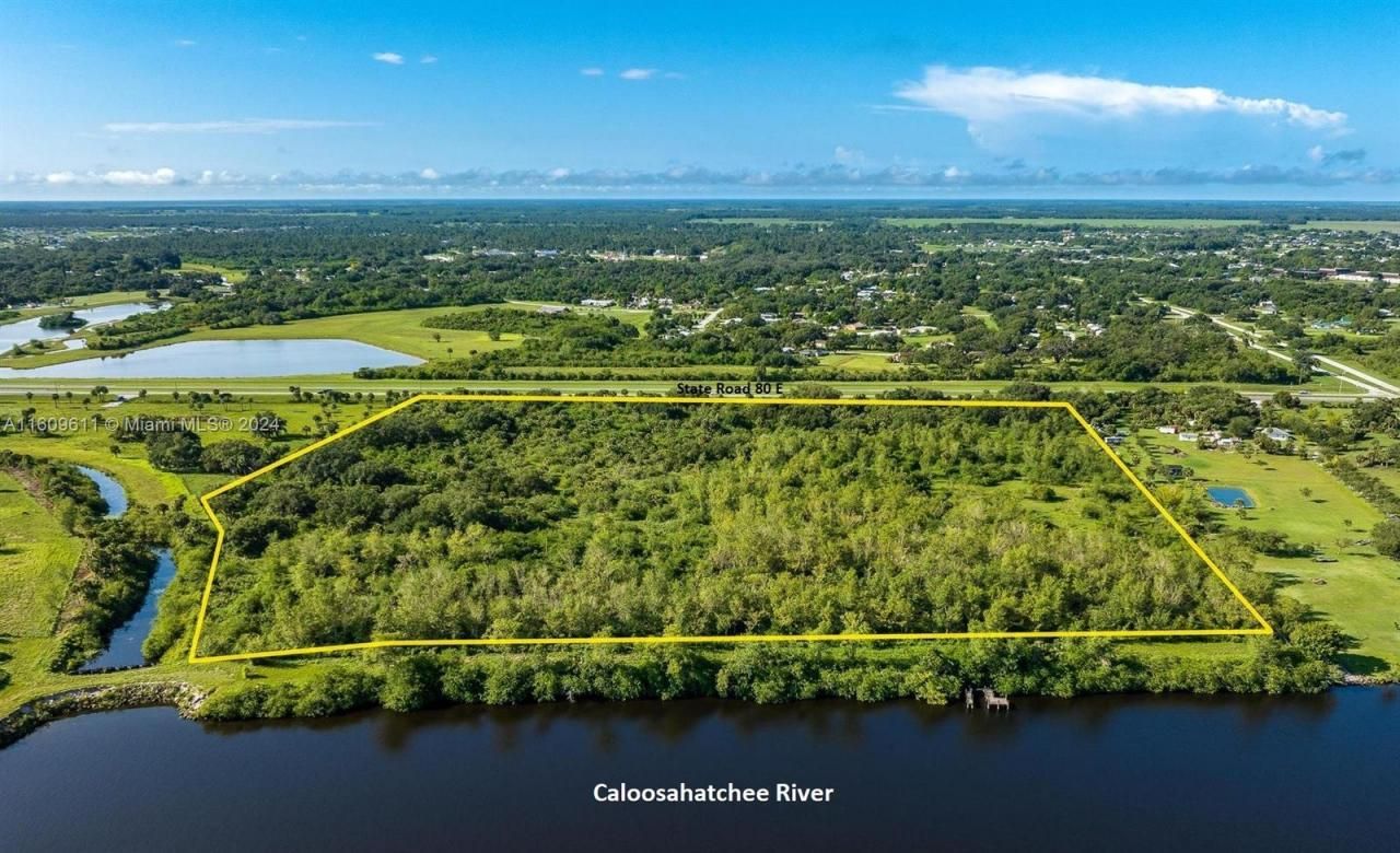
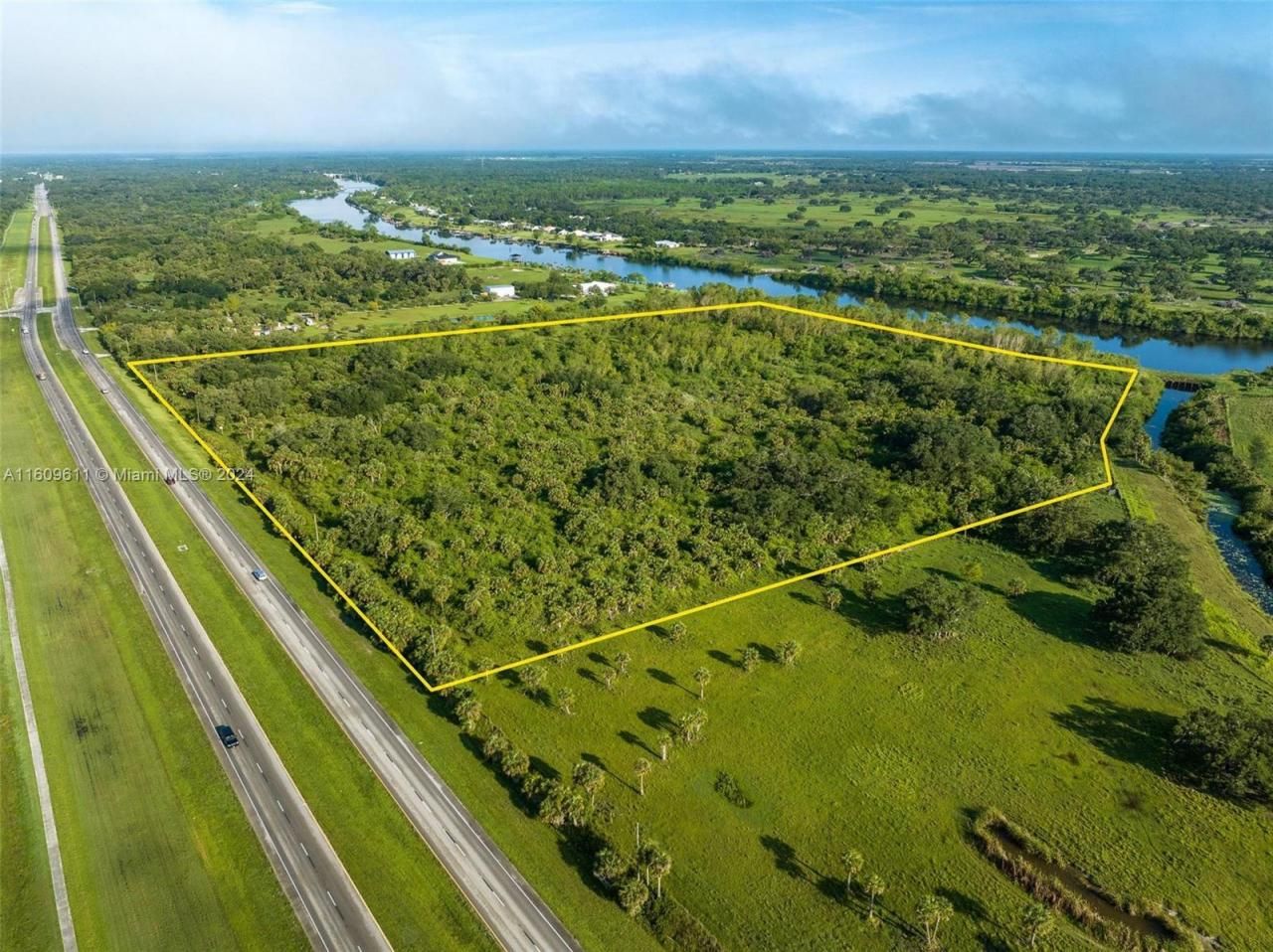
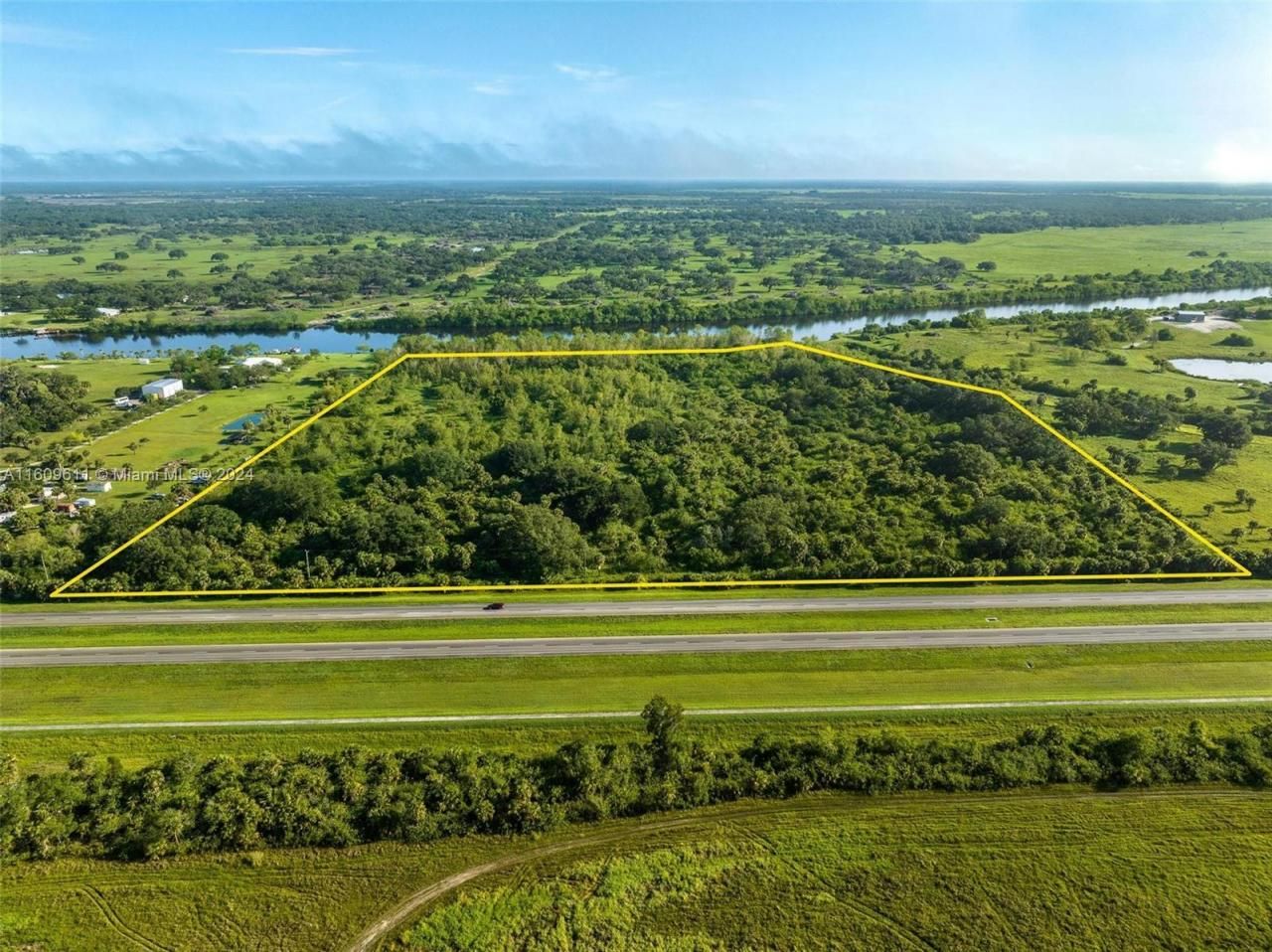
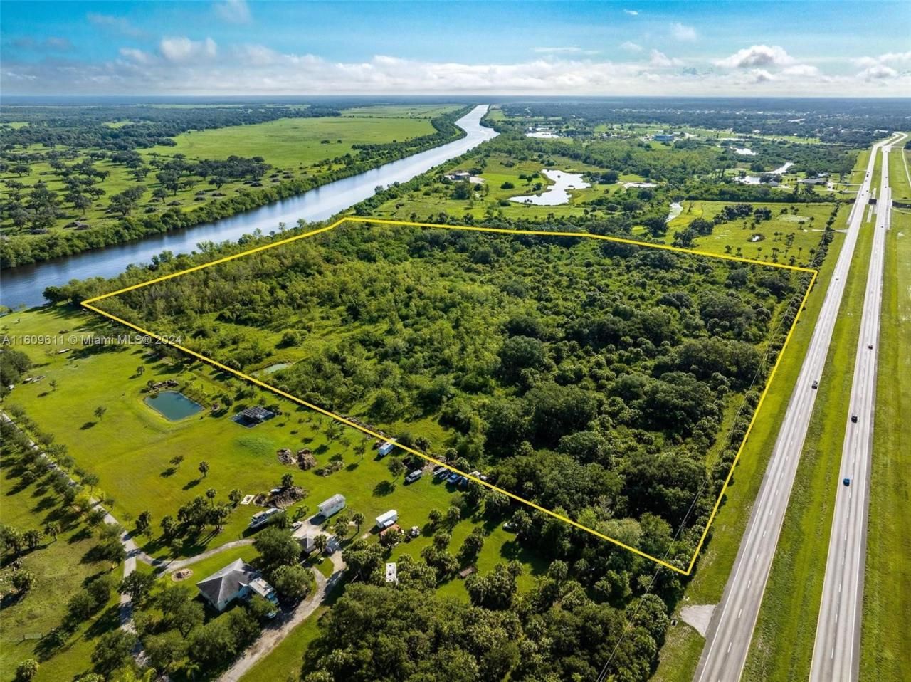
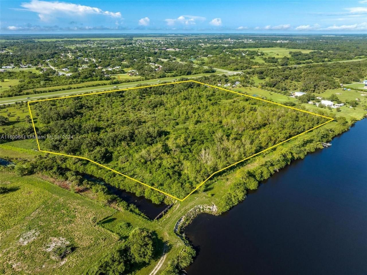
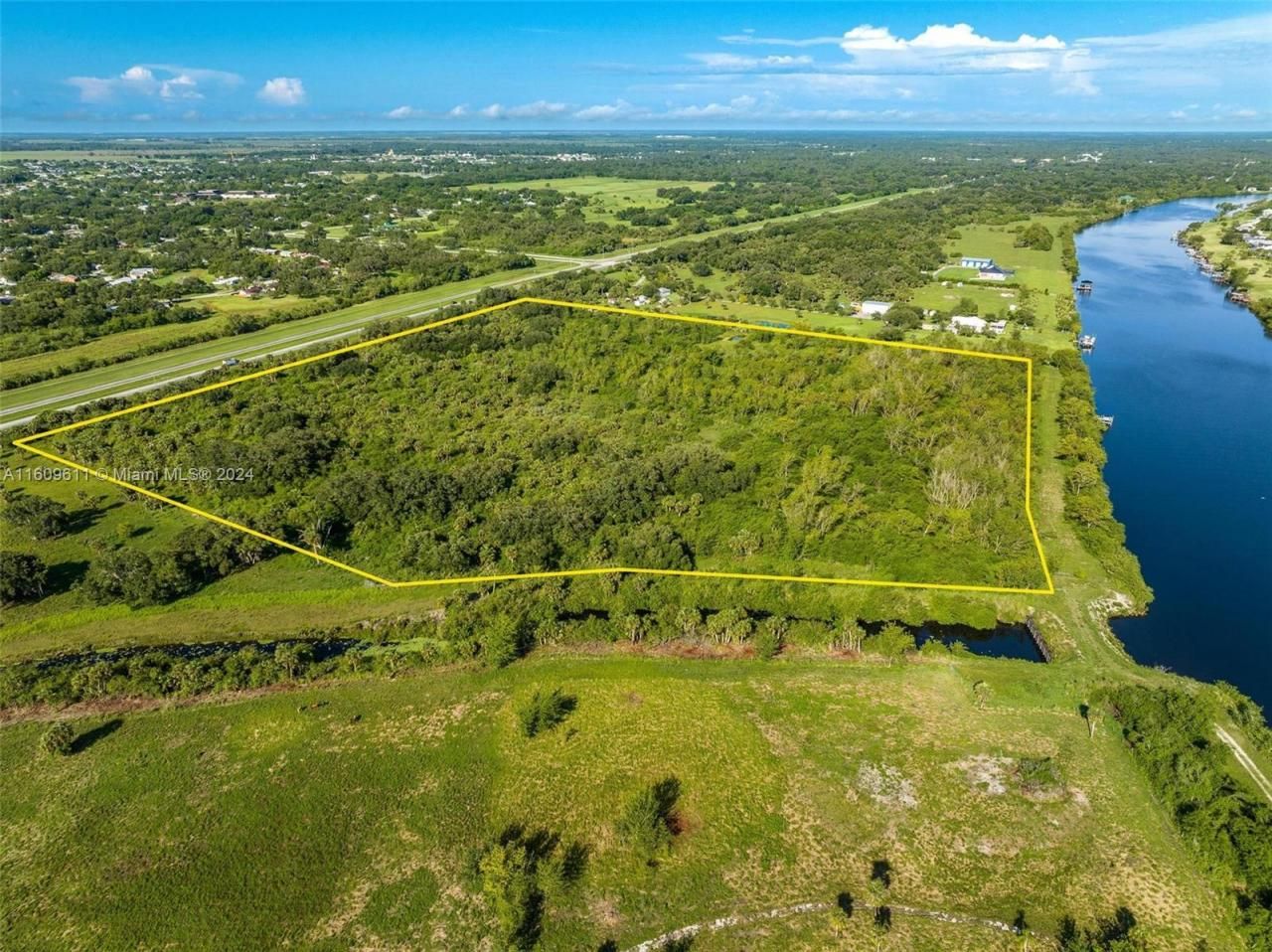
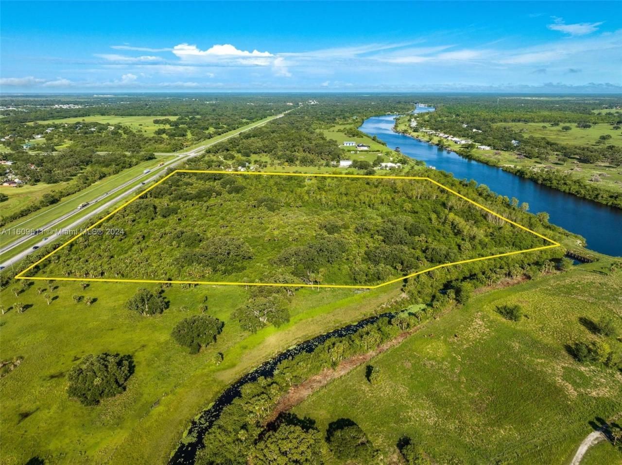
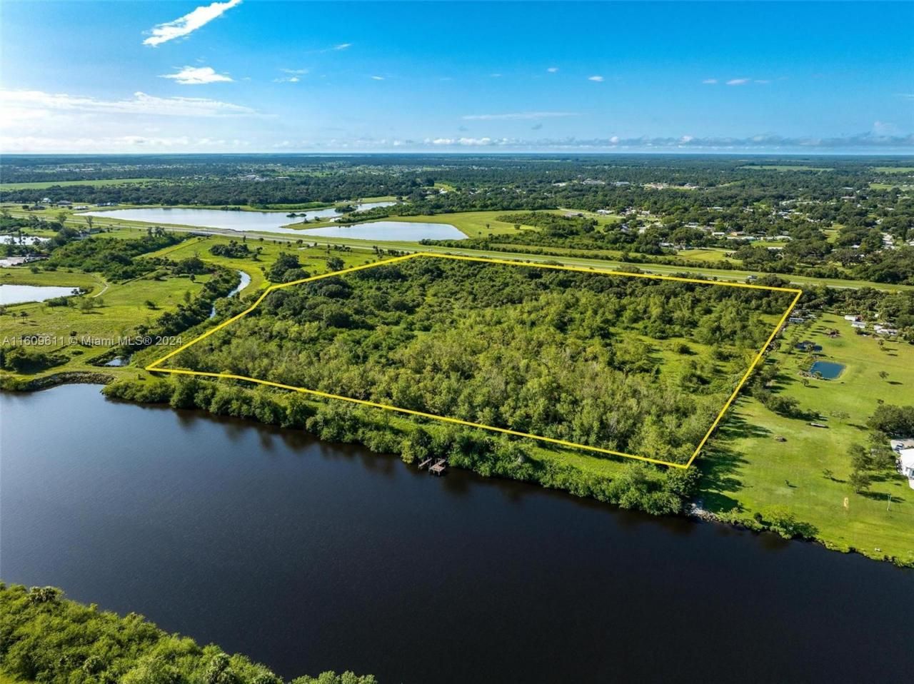
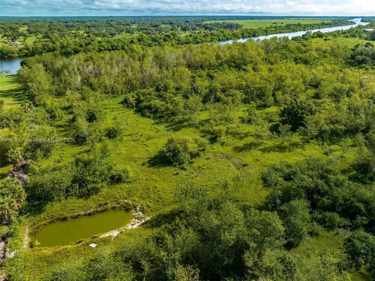
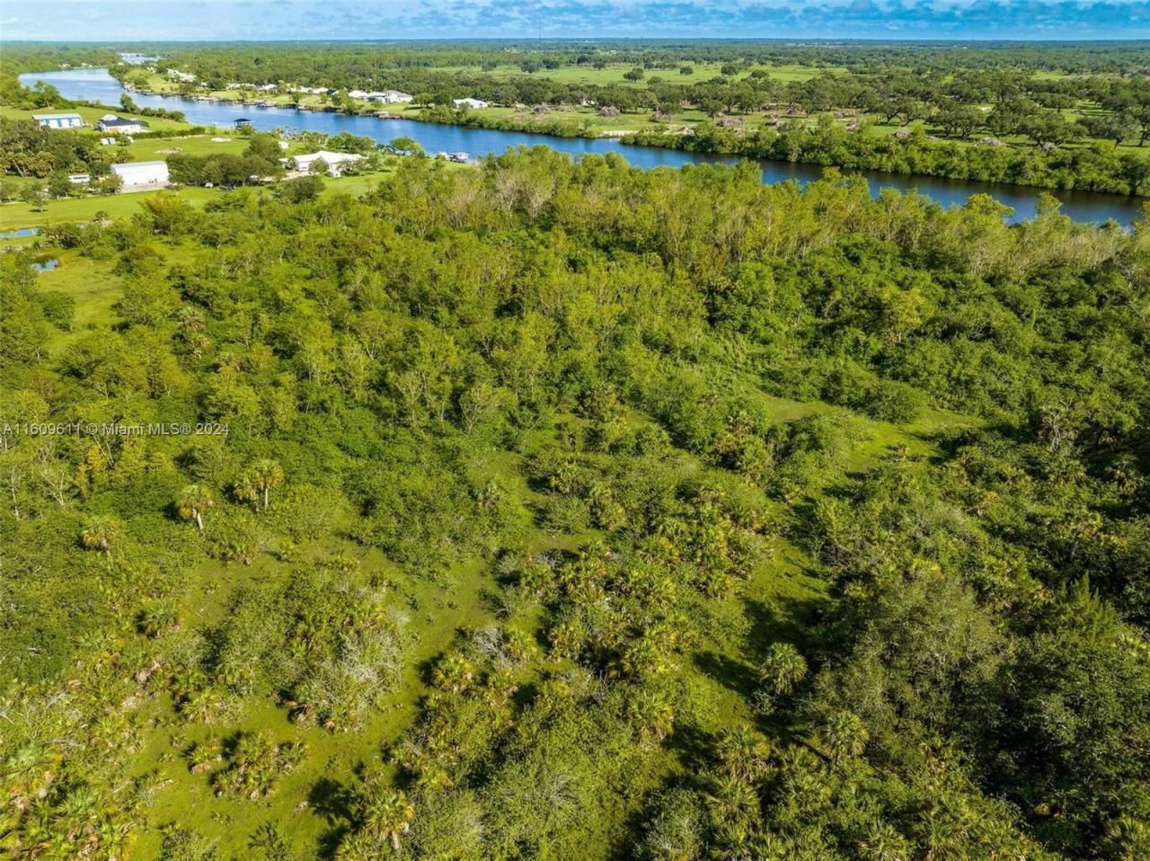
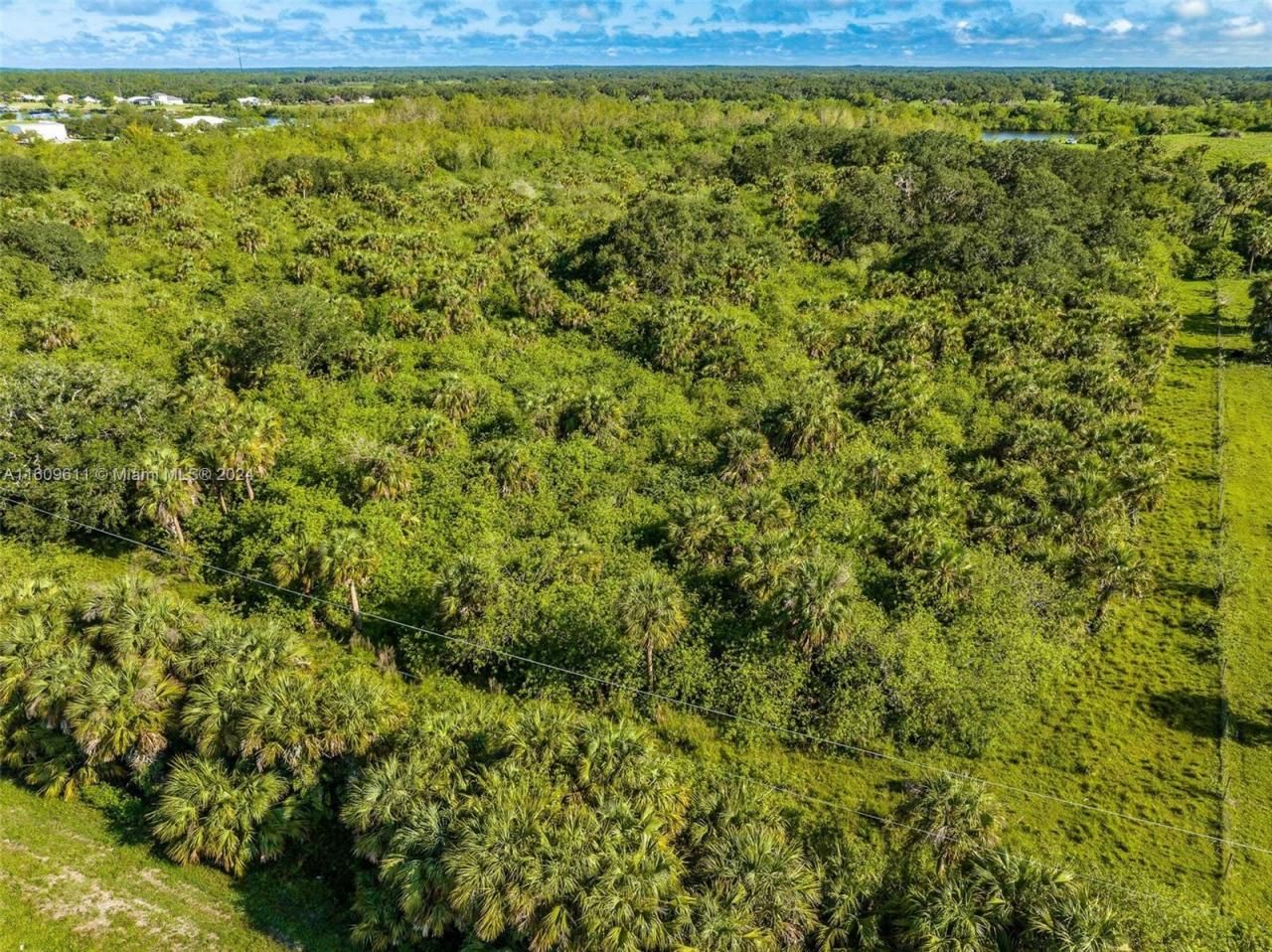
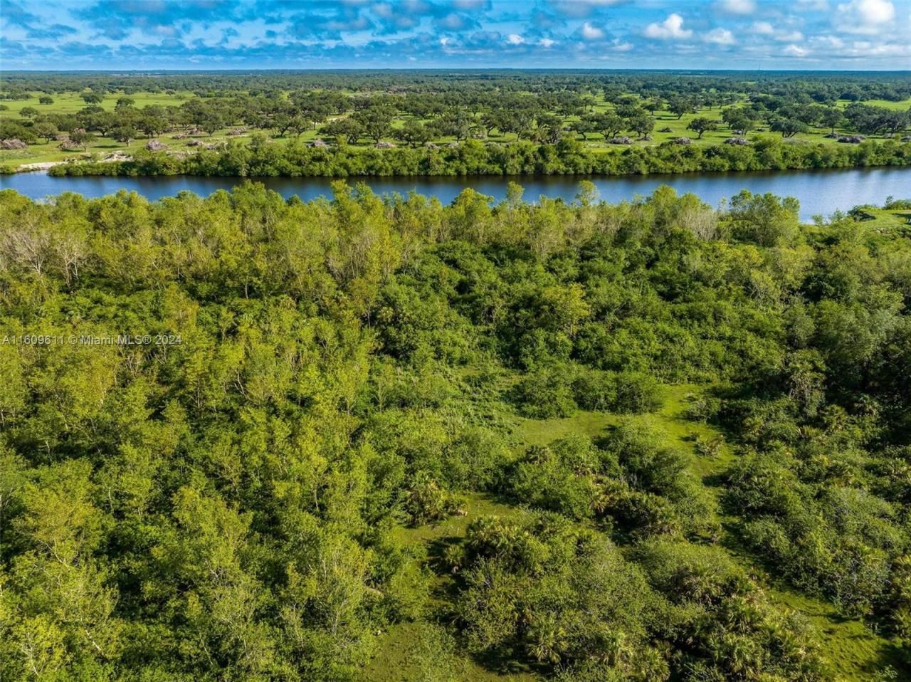
Lot Size31.47 acre(s)
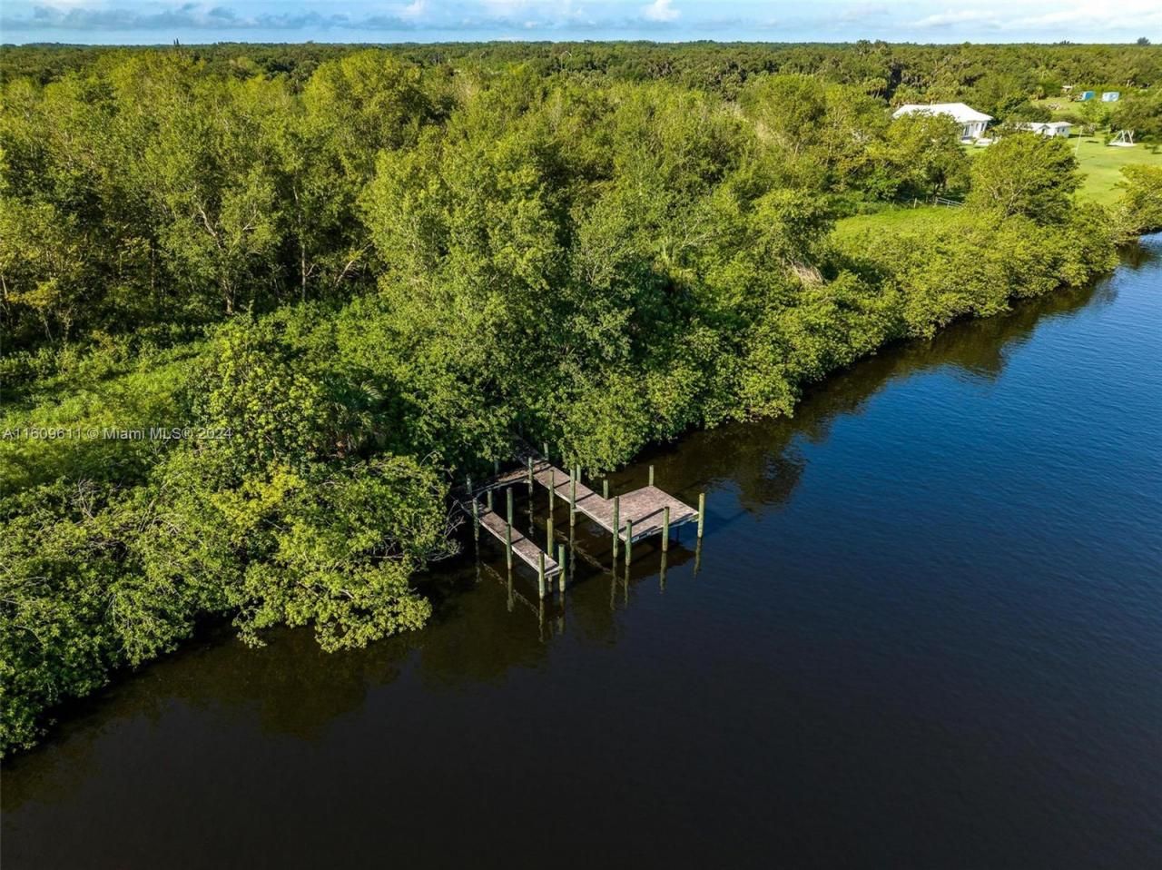
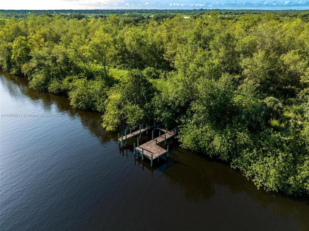
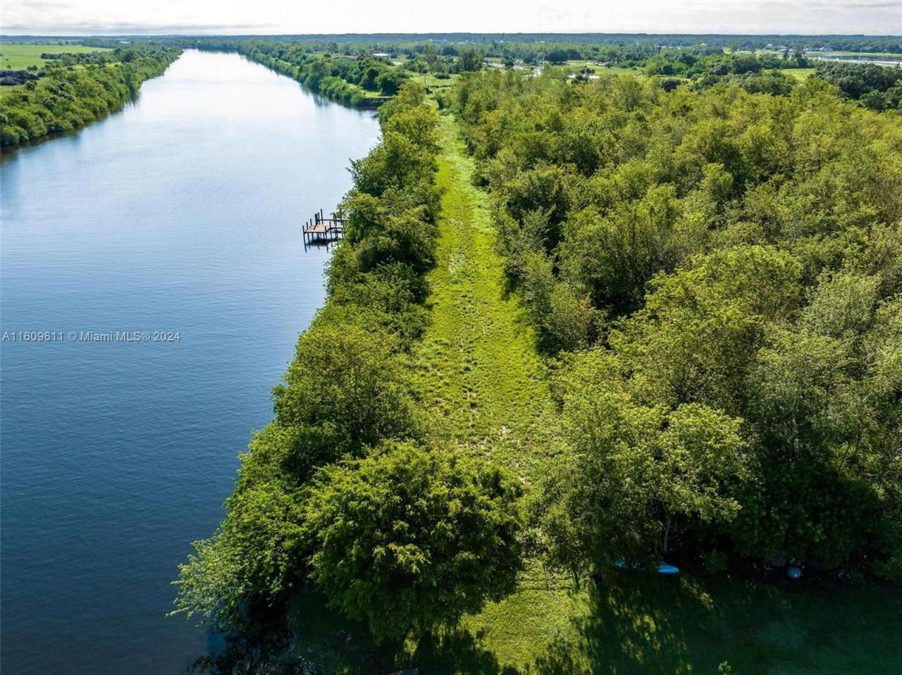
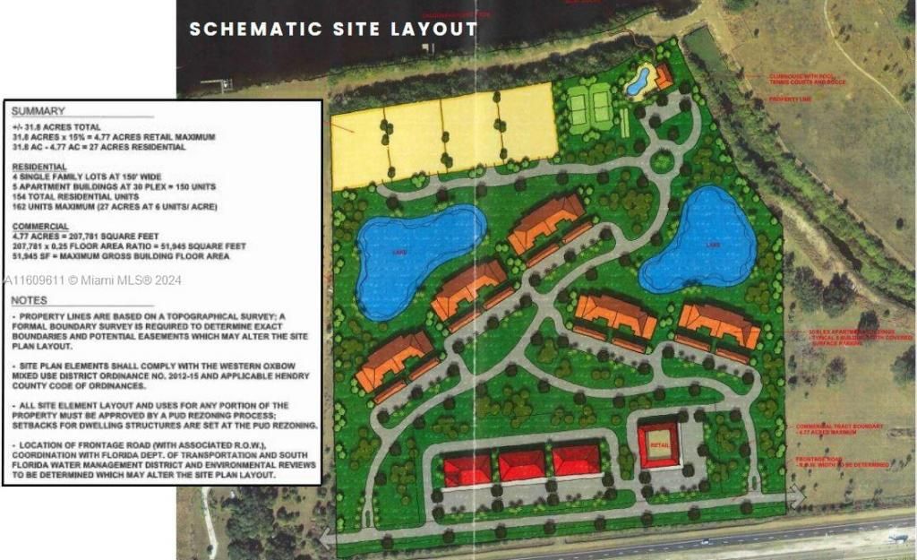
A DEVELOPER/INVESTORS DREAM PROPERTY boasting 1100+/- FT on SR 80 just east of the City of LaBelle, FL and 900+/- FT on the intracoastal waterway, the Caloosahatchee River segment. This 31.47 acres is currently zoned agricultural with the benefit of an agricultural exemption for low taxes. Municipal water and sewer line availability must be checked with Port LaBelle Utilities. The Future Land Use is Western Oxbow Mixed Use which allows commercial, not only on SR 80, but would be encouraged on th...
View MoreProperty Summary
Property Details
Neighborhood Information
Courtesy of
Agency Name: Southern Heritage Real Estate
Agent Name: Sherri Denning
Agency Phone: 863-675-4500

Presented by
Agent Name: The Legacy Group
Agent Phone: 561.282.5207
Agency Title: The Keyes Company
Request Info
Mortgage Calculator
Share by Email
Send an email with a link to
1984 E State Road 80, La Belle, FL 33935.
Email 1984 E State Road 80, La Belle, FL 33935
Print This Listing
Select a format below, new window will open and will prompt you to print.


Connect with Us
Disclaimer: All information deemed reliable but not guaranteed. All properties are subject to prior sale, change or withdrawal. Neither listing broker(s) or information provider(s) shall be responsible for any typographical errors, misinformation, misprints and shall be held totally harmless. Listing(s) information is provided for consumers personal, non-commercial use and may not be used for any purpose other than to identify prospective properties consumers may be interested in purchasing. Information on this site was last updated 07/17/2026. The listing information on this page last changed on 07/17/2026. The data relating to real estate for sale on this website comes in part from the Internet Data Exchange program of Delta Media Group MLS (last updated Fri 07/17/2026 12:13:41 AM EST) or Miami MLS (last updated Fri 07/17/2026 12:09:19 AM EST) or Stellar MLS (last updated Thu 07/16/2026 11:59:07 PM EST) or SPC MLS (last updated Thu 07/16/2026 11:21:09 PM EST) or Martin MLS (last updated Thu 07/16/2026 11:38:22 PM EST) or Indian River MLS (last updated Thu 07/16/2026 11:30:14 PM EST) or Daytona MLS (last updated Thu 07/16/2026 11:36:58 PM EST) or Fort Myers (last updated Thu 07/16/2026 11:04:35 PM EST) or Sanibel (last updated Thu 07/16/2026 11:23:24 PM EST) or Tallahassee MLS (last updated Thu 07/16/2026 10:48:26 PM EST) or Northeast Florida MLS (last updated Fri 07/17/2026 12:09:05 AM EST) or Beaches MLS (last updated Fri 07/17/2026 12:10:34 AM EST) or Naples MLS (last updated Thu 07/16/2026 11:40:27 PM EST) or Bonita Springs MLS (last updated Thu 07/16/2026 11:02:27 PM EST) or PBI MLS (last updated Thu 07/16/2026 11:21:27 PM EST) or Florida Keys MLS (last updated Thu 07/16/2026 8:30:16 PM EST). Real estate listings held by brokerage firms other than The Keyes Company may be marked with the Internet Data Exchange logo and detailed information about those properties will include the name of the listing broker(s) when required by the MLS. All rights reserved.
Privacy Policy / DMCA Notice / ADA Accessibility